
Science
NASA To Launch ICESat-2 Next Month To Track Earth’s Melting Polar Ice
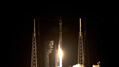
ICESat-2 will be launched on September 15 from Vandenberg Air Force Base

NASA is going to launch a cutting-edge, laser-armed satellite next month that will study the changes in Earth’s polar ice from above. In recent years, melting of the Greenland and Antarctica ice sheets alone have raised global sea level by more than a millimeter a year, which approximately accounts for one-third of observed sea level rise. It has become a matter of great concern now especially as the Earth is rapidly getting warmer and the ice sheets are now melting at a faster rate than ever before.
The Ice, Cloud, and land Elevation Satellite-2 (ICESat-2) will measure the average change in the thickness of individual patches of ice covering Greenland and Antarctica from season to season. The satellite, which is about the size of a smart car, will reportedly capture 60,000 measurements every second.
“ICESat-2 really is a revolutionary new tool for both land ice and sea ice research,” said Tom Neumann, NASA’s ICESat-2 deputy project scientist.
The mission will help scientist to understand what is causing ice sheets to melt fast. While the data collected by the satellite will help scientists in studying polar ice, the same data will also help them in studying forests around the planet.
ICESat-2 will follow two previous major NASA missions to monitor ice thickness. The original ICESat satellite was launched back in 2003. In 2009 when the mission ended, the US space agency launched Operation IceBridge, an airborne research campaign that kept track of the accelerating rate of change.
ICESat-2 will orbit about 300 miles above Earth’s surface. The Advanced Topographic Laser Altimeter System (ATLAS) onboard the satellite will constantly emit a laser beam of green light. The green laser light will get split into six separate beams at the time of leaving the satellite. The beams will then bounce off the surface of the ice in a grid pattern. While most of the photons in the laser beams will be lost, some of them will make their way back to the satellite.
“ATLAS required us to develop new technologies to get the measurements needed by scientists to advance the research,” said Doug McLennan, ICESat-2 Project Manager. “That meant we had to engineer a satellite instrument that not only will collect incredibly precise data, but also will collect more than 250 times as many height measurements as its predecessor.”
The satellite is currently scheduled to be launched from Vandenberg Air Force Base in California on September 15.